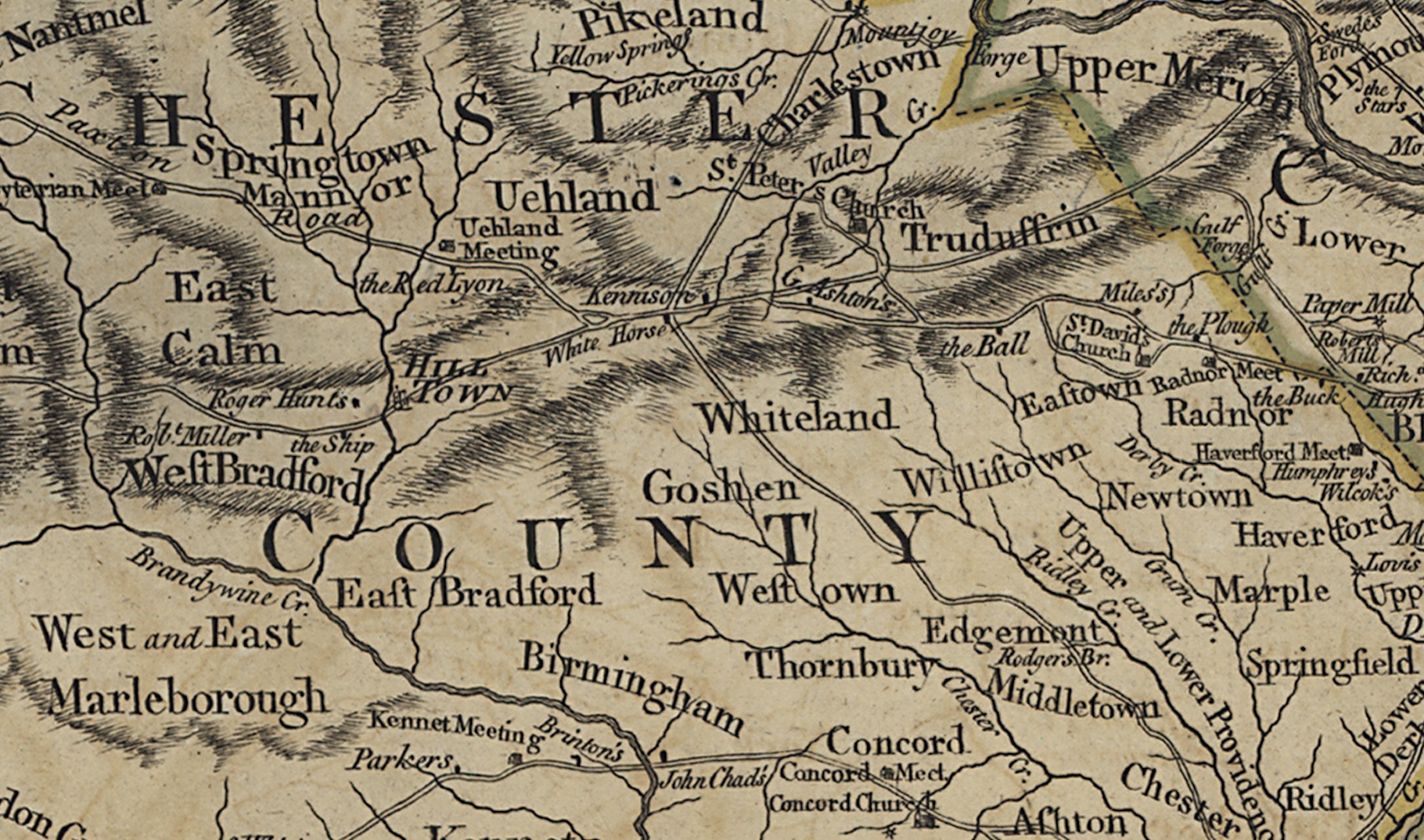
Map showing White Horse, laid down from actual surveys and chiefly from the late map of W. Scull published in 1770; and humbly inscribed to the Honourable Thomas Penn and Richard Penn, Esquires, true and absolute proprietaries & Governors of the Province of Pennsylvania and the territories thereunto belonging.
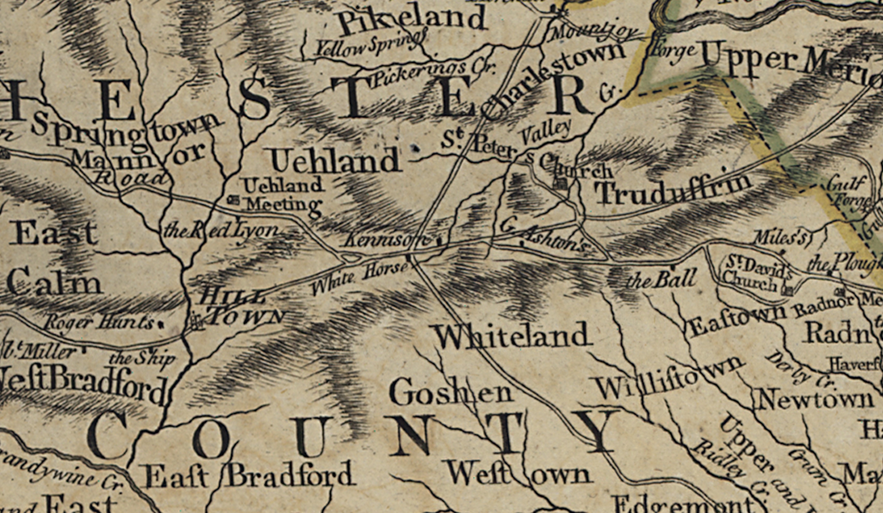
https://lccn.loc.gov/74692507
Robert Sayer and John Bennett (Firm) A map of Pennsylvania
exhibiting not only the improved parts of that Province, but
also its extensive frontiers: Laid down from actual surveys
and chiefly from the late map of W. Scull published in 1770;
and humbly inscribed to the Honourable Thomas Penn and
Richard Penn, Esquires, true and absolute proprietaries &
Governors of the Province of Pennsylvania and the
territories thereunto belonging. London, Printed for Robt.
Sayer & J. Bennett, 1775. Scale ca. 1:365,000.
     col. map 68 x 134 cm.
One thought on “Map–Pennsylvania exhibiting not only the improved parts of that Province, but also its extensive frontiers. 1770”