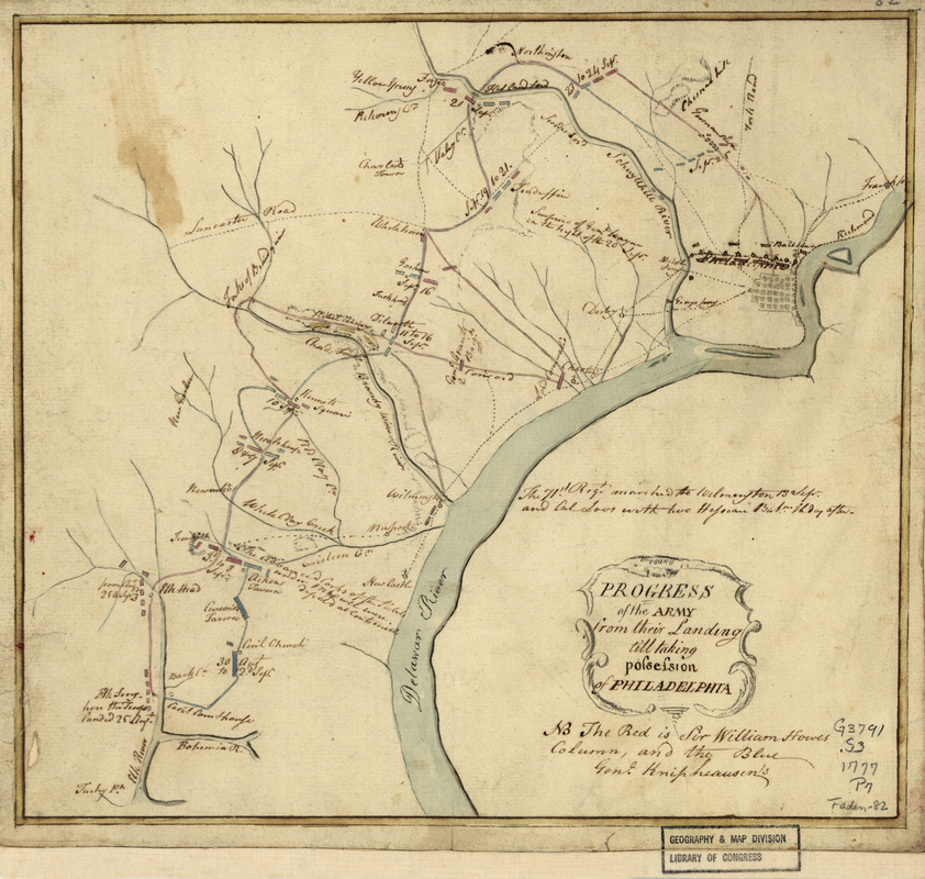
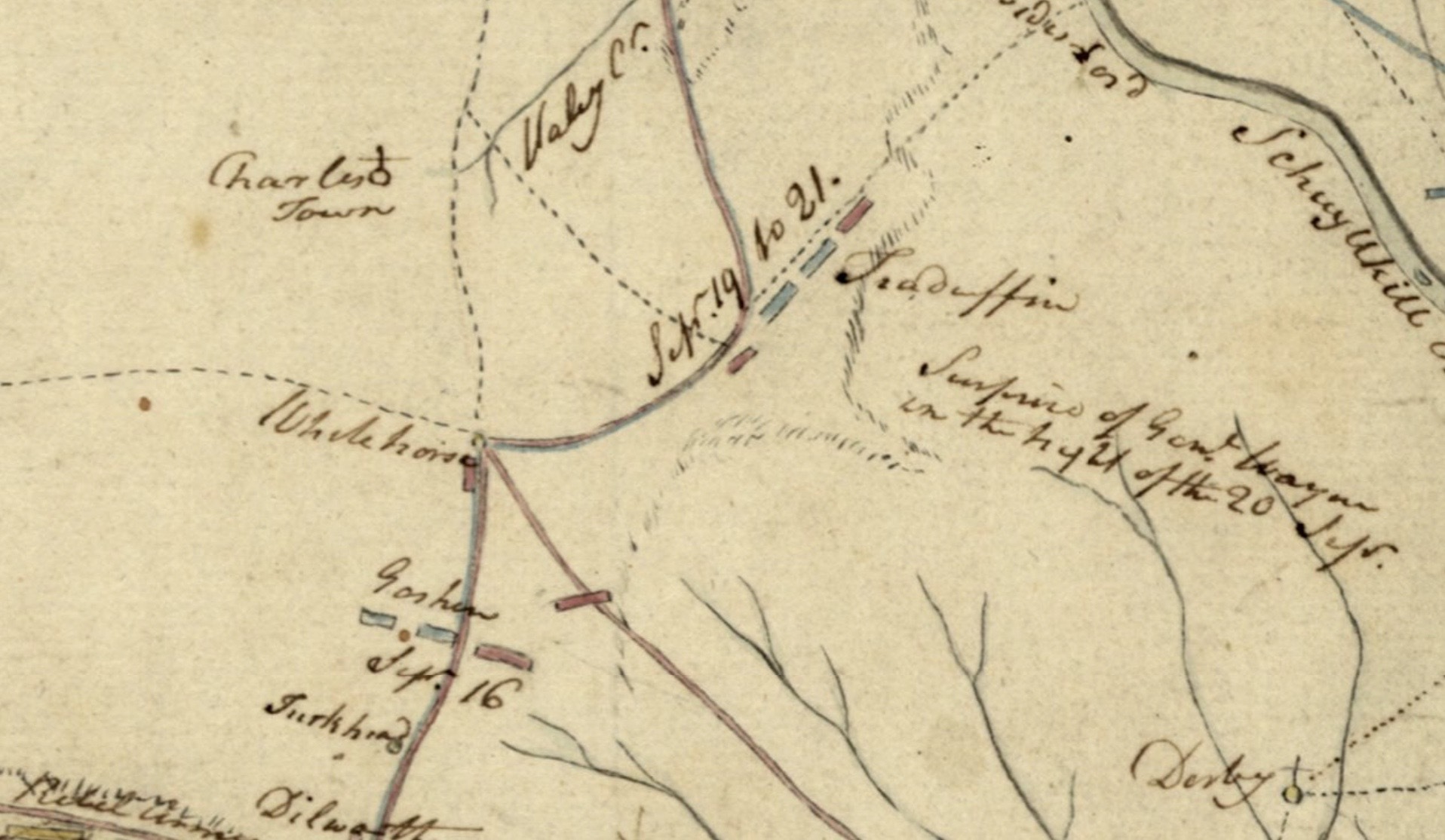
This map is probably drawn in 1777 or 1778. It is not to scale but is meant to provide a timeline of events. Red rectangles denote Howe’s column, which is placed right next to the intersecting roads where the White Horse is located.
Historic Property From ~1721
Historic Property From ~1721
This map is probably drawn in 1777 or 1778. It is not to scale but is meant to provide a timeline of events. Red rectangles denote Howe’s column, which is placed right next to the intersecting roads where the White Horse is located.
Historic Property From ~1721
One thought on “Map-Progress of the Army from their landing till taking possession of Philadelphia, 1777”