One of the most important atlases of the American Revolutionary War period. There are 22 maps on 29 sheets. The majority of the important large scale maps of the colonies are here, appearing together for the first time after having been issued as separates by Jefferys in the 1750’s and 60’s. This copy is the 1st 1776 edition,
The American Atlas: Or, A Geographical Description Of The Whole Continent Of America … Engraved On Forty-Eight Copper Plates, By The Late Mr. Thomas Jefferys, Geographer to the King, and Others. London, Printed and Sold by R. Sayer and J. Bennett, Map and Print Sellers, No. 53, Fleet-Street. MDCCLXXVI.
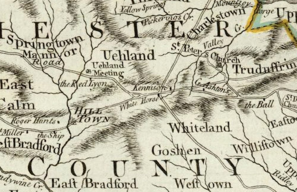
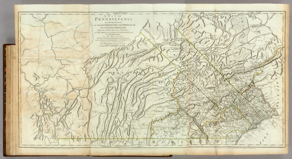
A Map Of Pennsylvania Exhibiting not only The Improved Parts of that Province, but also Its Extensive Frontiers: Laid down From Actual Surveys, and Chiefly From The Late Map of W. Scull Published in 1770; And Humbly Inscribed To The Honourable Thomas Penn And Richard Penn Esquires True And Absolute Proprietaries & Governors Of The Province Of Pennsylvania and the Territories thereunto belonging. London Printed for Robt. Sayer & J. Bennett … June 1775.
One thought on “Map–A Map Of Pennsylvania Jefferys, Thomas 1776”